Model toolbox
The tools in the Model toolbox are used to create an editable surface model, to classify laser points manually, to fix the elevation of points, and to update the surface model.
The tools for manual point classification effect points loaded in TerraScan memory. You have to save the points in order to store changes permanently into point files.
TO |
USE TOOL |
|
|---|---|---|
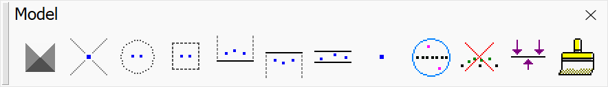
To create an editable triangulated model |
|
|
Assign class to a laser point |
|
|
Classify points using a brush |
|
|
Classify points inside fence |
|
|
Classify points above line in section view |
|
|
Classify points below line in section view |
|
|
Classify points close to line in section view |
|
|
Add a synthetic point using mouse click |
|
|
Classify noise points deviating from local surface |
|
|
Classify vegetation points out of ground |
|
|
Set elevation of points inside polygon(s) |
|
|
Rebuild model after classification |
|
|


Create Editable Model and Rebuild Model tools require TerraModeler to run.