

TerraModeler
With TerraModeler you can create, edit, and utilize surface models. TerraModeler creates surface models (TINs) from various sources, such as LiDAR points stored in binary files or loaded in TerraScan, XYZ ascii files and graphical design elements. The software offers versatile visualization options including colored shaded surfaces, contour lines, grids, colored triangle nets, elevation texts, slope directions and textured surfaces (in combination with TerraPhoto).
Additional functionality includes the production of contour lines and lattice models in batch processing, modification of the TIN, creation of profiles, calculation of volumes, calculation of elevation or volume differences between two surface models, several labeling options as well as other tools for design purposes. Completed with various export options, TerraModeler is a versatile tool for many kinds of design and modeling tasks.
TerraModeler is available in Full, UAV and Lite versions
Functionality matrix comparing TerraModeler, TerraModeler LITE, and TerraModeler UAV – Click to open
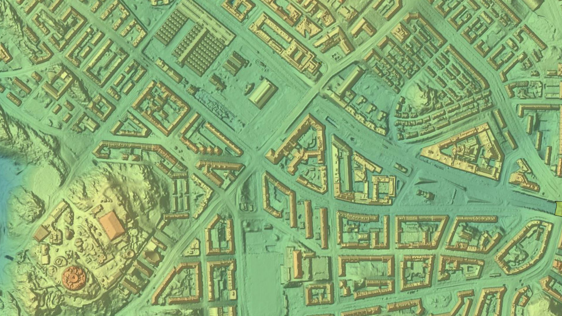
TerraModeler can use many different surface sources
Creation of surface models from several sources, e.g. laser points, breakline elements, xyz text files delivering the best possible results for the analysis or end product.
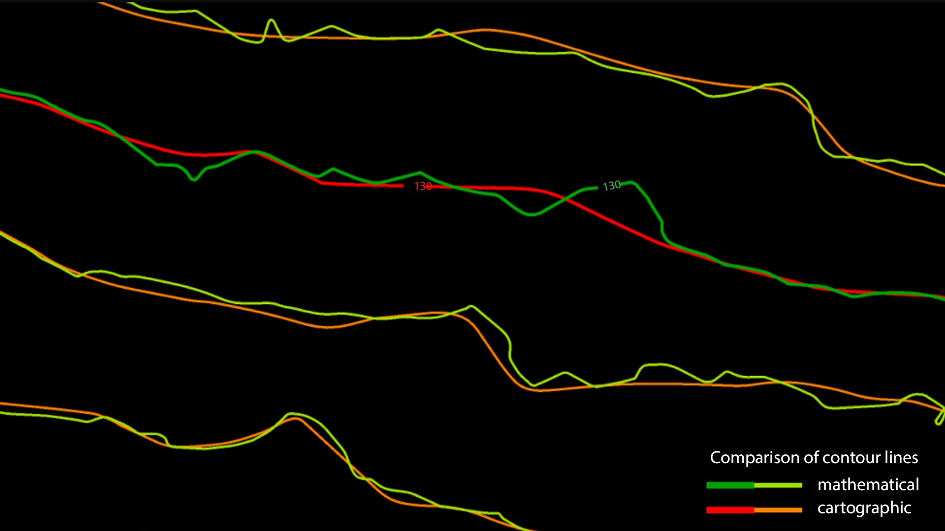
Contour line production
Contours are the traditional and familiar way of depicting elevation differences on a map. LiDAR produces a point cloud that represents the ground and objects on it. Points classified with TerraScan can be used as basis for contour line creation in TerraModeler. Terrasolid software distinguishes two types of contour lines. There are mathematical contour lines which follow the elevations of the laser points very accurately but are not very useful for mapping purposes and cartographic contour lines which are smooth and nice-looking but less accurate.
Applications
Urban planning | Architectural and historical site documentation and analysis | Emergency response, security and defense | Noise, flood, solar, shadow, visibility, lightning and wind analysis | Virtual reality | Visualization for communication of information to citizen | Radio-wave propagation | Mapping | Cartography | etc.
Purchase
Purchase our products here. We have three different purchasing options for perpetual, subscription and academic licenses. Contact us for more information about different purchasing options.
Download
Download the software of your choice from our Software Download center. A license is needed for all of our software. You can familiarize with our pricing options in the Pricing section.
Technical description
You can read more about the specifications and technical description for each Terrasolid product here if you want to have a more comprehensive understanding of our individual products.
Discover
Additional functionality includes the production of contour lines and lattice models in batch processing, modification of the TIN, creation of profiles, calculation of volumes, calculation of elevation or volume differences between two surface models, several labeling options as well as other tools for design purposes. Completed with various export options, TerraModeler is a versatile tool for many kinds of design and modeling tasks.
Get to know
I am text block. Click edit button to change this text. Lorem ipsum dolor sit amet, consectetur adipiscing elit. Ut elit tellus, luctus nec ullamcorper mattis, pulvinar dapibus leo. I am text block. Click edit button to change this text. Lorem ipsum dolor sit amet, consectetur adipiscing elit. Ut elit tellus, luctus nec ullamcorper mattis, pulvinar dapibus leo.
I am text block. Click edit button to change this text. Lorem ipsum dolor sit amet, consectetur adipiscing elit. Ut elit tellus, luctus nec ullamcorper mattis, pulvinar dapibus leo. I am text block. Click edit button to change this text. Lorem ipsum dolor sit amet, consectetur adipiscing elit. Ut elit tellus, luctus nec ullamcorper mattis, pulvinar dapibus leo.