Draw polygons
Draw polygons command draws 3D shapes or line strings around groups of points within one or more point classes. The elevation of the vertices for the elements is derived from the elevation values of the laser points.
Optionally, grouping of points can be taken into account for drawing polygons. The requires the assignment of group numbers to points by using the Assign groups menu command or macro action.
To draw polygons around groups of points:
1. Select Draw polygons command from the Tools pulldown menu.
This opens the Draw Polygons dialog:
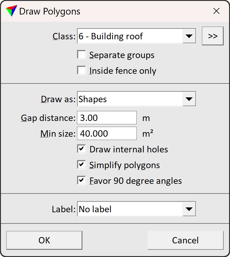
2. Define settings and click OK.
This draws the shape or line string elements around point groups into the CAD file. The elements are drawn on the active level using the active symbology of the CAD file.
SETTING |
EFFECT |
|---|---|
Class |
Source class(es) of laser points. Shapes or line strings are drawn around point groups of the given class(es). |
|
Opens the Select classes dialog which contains the list of active classes in TerraScan. You can select multiple source classes from the list that are then used in the Class field. |
Separate groups |
If on, a separate polygon is drawn around points belonging to one group. |
Inside fence only |
If on, only the area inside a fence or selected polygon is considered for processing. Requires that a fence is drawn or a polygon is selected in the CAD file. |
Draw as |
Definition of the element type that is created: Shapes, Line strings, Circles or Bounding boxes (for Separate groups only). |
Gap distance |
Maximum gap between points. Points which are less than the given distance away from each other are considered to belong to the same group. |
Min size |
Minimum size of a polygon to be drawn. |
Draw internal holes |
If on, void areas inside point clusters are represented with holes in polygon shapes. If off, boundary is vectorized only. |
Simplify polygons |
If on, unnecessary vertices of the polygons are removed. This is only active if Draw as is set to Shapes or Line strings. |
Favor 90 degree angles |
If on, 90 degree angles are enforced for close-to 90 degree angles. This is only active if Draw as is set to Shapes or Line strings. |
Label |
Text element written for each polygon: •No label - no text element is created. •Polygon number - unique number. •Group id - the unique group number created during the the grouping process. |
